Thursday, September 4, 2014

The Gold Rush

After two days in Yosemite (without cell phone, wifi, blog access, or Facebook, much to the consternation of family and friends) we bounced out of the campground at 6:55 am, ready to tackle the roads yet again.  You see we had to go back down the Priest Grade (see prior post) that we went up two days earlier and reverse course over the 75 mile/2hour drive just to get to CA 49.  But this was going to be worth it, because the aptly named route 49 is the road that travels 90+ miles through California Gold Rush Country, 49ers, placer claims, pan for gold and all that fun stuff.  We admit, we checked out the AAA tour books to know where to stop first.....

And did not find any of it.  Oh, we stopped at the first three places the books guided us to, only to be told the "museum was closed", the guide "cannot be reached", and "it's the beginning of the slow season".  Really?  Three days after Labor Day which had you all booked up and now you can't bother with the tourists?  Well, OK, we'll just go to the Marshall Gold Discovery State Park, then.  Which we did, to find the parking lot torn up and a school bus of bored teenagers sitting around under the trees waiting for...someone.

Here is the recreated Sutter's Mill

The day was not a total bust, however as we did find lots and lots and lots of GOLD.   In the form of gold colored signs that warned us of

Steep grades of up to 13%

And winding roads

And they were not kidding today, again, either.  This was the typical view for the 150 miles on which we averaged about 36 miles per hour. Really.  When we were getting close to our destination, a song came on the radio.  It was Sheryl Crow singing "Everyday is a Winding Road".  Yes, we have discovered the Theme Song for this road trip, I do believe.

We are now happily camped in Auburn, CA on route 49.  We have wifi, cell coverage, air conditioning, laundry facilities, a pool and a hot tub.  And rose bushes out my window.  I can handle that.

One final note: with all the sporadic contact ability, I am having to post where and when I can.  Sometimes that means two or three posts on one day followed by silence for a couple of days.  I apologize for that, but it is an adventure, right?


Yosemite

While at Fort Bragg, Tom was doing his usual safety check on the Beach House and discovered that our front right tire is wearing unevenly.  So our first order of business was to have that checked out on Tuesday after Labor Day.  So it was up and over the mountains on yet another twisty, winding road, posted as 55 mph but really not possible in an RV at more than about 35 mph.  


Except for logging trucks, but they take up both lanes on the corners, which is about every 100 yards.  One hour to drive the 36 miles over the mountains to Ukiah.   Then a stop at the tire place, where we confirmed it is likely a camber problem, not an alignment issue.  

So after that delay, we hit the road for Yosemite.  More country highway at this point, and we went through Napa and Sonoma.  No visible evidence of the earthquake in the towns we went through, but we did not go into down town Napa.   We made good time until we got to Priest Grade.  Here is an image I borrowed from the internet:

Yep, more twisting and winding roads.  It took us two and a half hours to travel about 90 miles, but the good thing about that was at the end of it we had this view. 

And our wooded campsite had this

We were so exhausted after the long day of just getting there that we turned in early and conked out around 8:30.

The next day we decided to simply drive the scooter around the valley and take in some of our favorite sights.


This is looking back down the valley towards El Capitan, the largest granite monolith in the world.

We sat out on the patio at the Awahnee Hotel and this deer family showed up to mow the lawn.
Check out the still visible spots on the fawns.

It was a good day to sit and do not much but look at the grandeur.  It was also hot, about 92, which made us very happy to sit in the shade, watch the birds and the grass sway and eat an ice cream bar from the deli.


Glass Beach Fort Bragg

We spent the other half of Labor Day weekend driving down Highways 101 and 1 to Fort Bragg.  Our main goal here was to see Glass Beach, where the sand is literally chunks of glass that have been smoothed and polished by the waves crashing on the rocks.  Not a sharp edge anywhere, but the beach is jewels of colored glass.  All this beauty is, and was, trash.  Many years ago, the town used these cliffs as their town dump!  The glass and a few bits of brick and pottery are what remain.

Tom took the best pictures, and I will try to upload his at a later point... But this is what I have now.
From down low, you can see all the jewel colors.


From this far up, it doesn't look like much, does it?  That is Tom on the lower left searching at low tide.


This is my photo of a squirrel's Beach House.  Right in the bluffs crawling up from Glass Beach.


Sunday, August 31, 2014

Random Road Observations

In no particular order, here are the realizations we have come to over the past few days and weeks.

1.  The leftover hippies who did not move on to adulthood now all live along Highway 101.  They operate glassblowing shops, pottery shops and fortune-telling shops.  Surprisingly, none of them seem to be doing macrame any longer.

2.  As lovely as it is, pretty much anywhere along the Oregon Coast looks the same as any other section of the Oregon Coast.  If you want to see it, pick a spot that has something else you want to do/see and visit it for a few days instead of driving the length of it.  Trust me on this.  No offense to Oregonians, or anyone with a special spot.  

3.  If you live with one weather anomaly (sunny days) for 300+ days a year, any other weather anomaly (fog) is interesting for the first five days.  Then it starts to wear on you and you realize that a) Seasonal Affective Disorder really does run in your family b) you have chosen to live in a sunny climate for a Medical Reason.

4.  Fresh blueberries and blackberries off the bushes in your campsite are one of the most decadent pleasures to be found anywhere. Especially when it happens for five days in a row.

5.  The leak is still there, we are just really good at keeping it contained and ignoring it at the same time.

6.  The folks who designed the Autopia at Disneyland are apparently the same folks who designed Highway 1.  Which I am pretty sure was also the prototype for Space Mountain.  

I know I had it here somewhere...

I wrote a lovely post about our two days at Patrick's Point in northern CA....and have no idea where it went.  We liked it a lot even though it was much different than my childhood memory.


Funny thing, the midday is bright and sunny, but the fog rolls in thick around five.  Thick enough to cause it to 'rain' from the leaves of the trees.  I might be having enough fog by now....

This morning we continued south to Ft. Bragg, CA.  Home of the Skunk Railroad and Glass Beach.  The last 40 miles were via CA Highway 1, average speed was 27 miles per hour in the Beach House.  

We both have seen enough of Highway 1, but there is more to come next week.

Friday, August 29, 2014

Cape Arago and the Oregon Coast

(Thursday 28th)
We left Tillamook mid-morning for our 180 mile drive down US 101.  It is an interesting drive full of amazing views around the bend interspersed with tunnels of green where even the satellite radio cannot penetrate.  

Speaking of which, we had great internet but no cell service last night.  Today we had a little cell service in towns, but none at camp tonight, so no internet either, and I am not sure when this will get posted as we are headed to Redwoods Nat'l Park tomorrow and then another state park near Trinidad, CA for two days. 

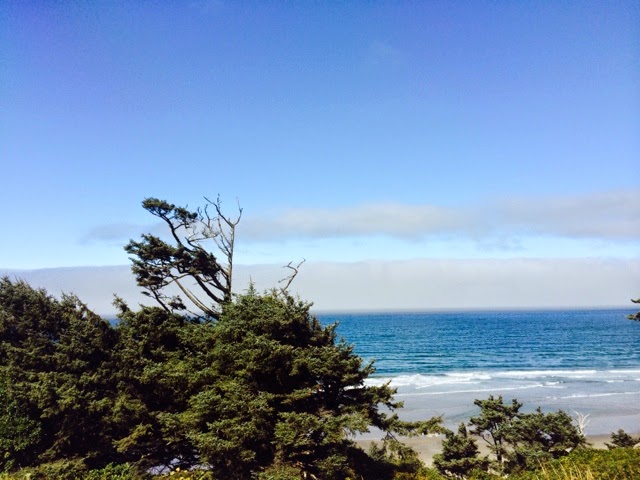
The vistas on the Oregon coast are one of two views; either a broad expanse of empty sand (shockingly empty to a native Southern Californian) or a rocky cliff side dropping down to the water just waiting to smash something to smithereens.  After a while they all started to look the same.  I know that sounds terrible, almost blasé about these gorgeous views, but I honestly have no clue which was taken where. But you will find all of these all along the coast everywhere.


Lighthouse in the trees


And yes, on the highway it becomes a 25 mph Main Street at each small town.


No doubt these little beach towns were a big part of why the drive took nearly five hours, and that is without counting the stop at the gas and grocery.

We are pooped after the long day, and the marine layer has moved inland making our blue sky and ocean turn gloomy. Time for some hot spaghetti for dinner!

Post Script:
The fog has thickened to where the nearby foghorn blasts every 90 seconds. It's not too bad with all windows closed and Schubert's violin concerto in D playing on the radio.  Tom is outside, having discovered some ripe blackberry bushes in our campsite.  Berries and ice cream for dessert tonight.


Wednesday, August 27, 2014

Olympic National Park

Greetings from the rain forest, where the fog moves in and out of the gnarled tree trunks in a ghostly creep.

This is the view literally out our door

And by literally, I mean this:
See the doorframe?

We are at Kalaloch (pronounced Clay-lock) on the Pacific Coast of Olympic National Park.  For us New Mexican desert rats, the foggy moist weather is a fun alternative.  The locals tell us the weather here is always either windy or foggy, and we know windy, so we'll take foggy.

The ocean is about 50 yards in front of us, but seeing it depends on how much fog is around.  We do hear the crashing waves, however.  In fact, the coastline is all glacial gravel and sand, which washes away on the waves, and is thus eroding at the rate of about a foot every couple of years.  The ocean front camp sites are getting smaller day by day.  


This erosion is also part of the reason huge trees and logs are all over the beach, along with dire warning signs not to walk on the beach when the tide is high.  The logs toss around and have crushed people.

Written on Tuesday Aug. 25